🗊 Презентация Radar and Satellite Remote Sensing

Категория: Технология
Нажмите для полного просмотра!
Radar and Satellite Remote Sensing, слайд №1 Radar and Satellite Remote Sensing, слайд №2 Radar and Satellite Remote Sensing, слайд №3 Radar and Satellite Remote Sensing, слайд №4 Radar and Satellite Remote Sensing, слайд №5 Radar and Satellite Remote Sensing, слайд №6 Radar and Satellite Remote Sensing, слайд №7 Radar and Satellite Remote Sensing, слайд №8 Radar and Satellite Remote Sensing, слайд №9 Radar and Satellite Remote Sensing, слайд №10 Radar and Satellite Remote Sensing, слайд №11 Radar and Satellite Remote Sensing, слайд №12 Radar and Satellite Remote Sensing, слайд №13 Radar and Satellite Remote Sensing, слайд №14 Radar and Satellite Remote Sensing, слайд №15 Radar and Satellite Remote Sensing, слайд №16 Radar and Satellite Remote Sensing, слайд №17 Radar and Satellite Remote Sensing, слайд №18 Radar and Satellite Remote Sensing, слайд №19 Radar and Satellite Remote Sensing, слайд №20 Radar and Satellite Remote Sensing, слайд №21 Radar and Satellite Remote Sensing, слайд №22 Radar and Satellite Remote Sensing, слайд №23 Radar and Satellite Remote Sensing, слайд №24 Radar and Satellite Remote Sensing, слайд №25 Radar and Satellite Remote Sensing, слайд №26 Radar and Satellite Remote Sensing, слайд №27 Radar and Satellite Remote Sensing, слайд №28 Radar and Satellite Remote Sensing, слайд №29 Radar and Satellite Remote Sensing, слайд №30 Radar and Satellite Remote Sensing, слайд №31 Radar and Satellite Remote Sensing, слайд №32 Radar and Satellite Remote Sensing, слайд №33 Radar and Satellite Remote Sensing, слайд №34 Radar and Satellite Remote Sensing, слайд №35 Radar and Satellite Remote Sensing, слайд №36 Radar and Satellite Remote Sensing, слайд №37 Radar and Satellite Remote Sensing, слайд №38 Radar and Satellite Remote Sensing, слайд №39 Radar and Satellite Remote Sensing, слайд №40 Radar and Satellite Remote Sensing, слайд №41 Radar and Satellite Remote Sensing, слайд №42 Radar and Satellite Remote Sensing, слайд №43

Содержание
Вы можете ознакомиться и скачать презентацию на тему Radar and Satellite Remote Sensing. Доклад-сообщение содержит 43 слайдов. Презентации для любого класса можно скачать бесплатно. Если материал и наш сайт презентаций Mypresentation Вам понравились – поделитесь им с друзьями с помощью социальных кнопок и добавьте в закладки в своем браузере.
Слайды и текст этой презентации


Слайд 1


Radar and Satellite Remote Sensing Chris Allen, Associate Director – Technology Center for Remote Sensing of Ice Sheets The University of Kansas
Описание слайда:
Radar and Satellite Remote Sensing Chris Allen, Associate Director – Technology Center for Remote Sensing of Ice Sheets The University of Kansas

Слайд 2


Outline Background – ice sheet characterization Radar overview Radar basics Radar depth-sounding of ice sheets Example of capabilities of modern...
Описание слайда:
Outline Background – ice sheet characterization Radar overview Radar basics Radar depth-sounding of ice sheets Example of capabilities of modern radars Synthetic-aperture radar (SAR) Satellite sensing Spaceborne radars Satellite radar data products Future directions

Слайд 3


Background Sea-level rise resulting from the changing global climate is expected to directly impact many millions of people living in low-lying...
Описание слайда:
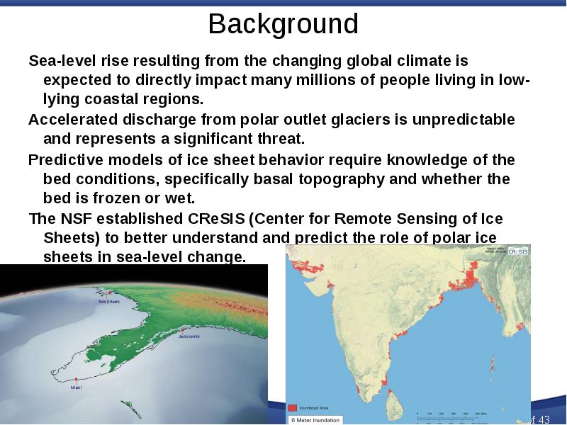
Background Sea-level rise resulting from the changing global climate is expected to directly impact many millions of people living in low-lying coastal regions. Accelerated discharge from polar outlet glaciers is unpredictable and represents a significant threat. Predictive models of ice sheet behavior require knowledge of the bed conditions, specifically basal topography and whether the bed is frozen or wet. The NSF established CReSIS (Center for Remote Sensing of Ice Sheets) to better understand and predict the role of polar ice sheets in sea-level change.

Слайд 4


CReSIS technology requirements: Radar Technology requirements are driven by science, specifically the data needed by glaciologists to improve our...
Описание слайда:
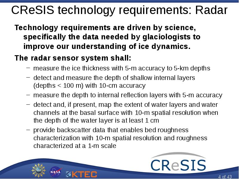
CReSIS technology requirements: Radar Technology requirements are driven by science, specifically the data needed by glaciologists to improve our understanding of ice dynamics. The radar sensor system shall: measure the ice thickness with 5-m accuracy to 5-km depths detect and measure the depth of shallow internal layers (depths < 100 m) with 10-cm accuracy measure the depth to internal reflection layers with 5-m accuracy detect and, if present, map the extent of water layers and water channels at the basal surface with 10-m spatial resolution when the depth of the water layer is at least 1 cm provide backscatter data that enables bed roughness characterization with 10-m spatial resolution and roughness characterized at a 1-m scale

Слайд 5


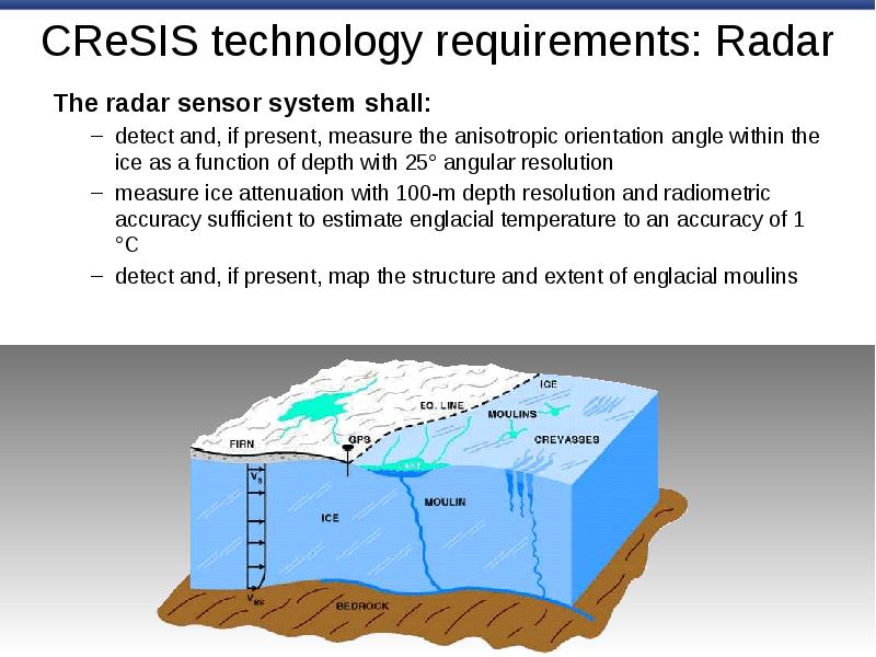
CReSIS technology requirements: Radar The radar sensor system shall: detect and, if present, measure the anisotropic orientation angle within the ice...
Описание слайда:
CReSIS technology requirements: Radar The radar sensor system shall: detect and, if present, measure the anisotropic orientation angle within the ice as a function of depth with 25° angular resolution measure ice attenuation with 100-m depth resolution and radiometric accuracy sufficient to estimate englacial temperature to an accuracy of 1 °C detect and, if present, map the structure and extent of englacial moulins

Слайд 6


A brief overview of radar Radar – radio detection and ranging Developed in the early 1900s (pre-World War II) 1904 Europeans demonstrated use for...
Описание слайда:
A brief overview of radar Radar – radio detection and ranging Developed in the early 1900s (pre-World War II) 1904 Europeans demonstrated use for detecting ships in fog 1922 U.S. Navy Research Laboratory (NRL) detected wooden ship on Potomac River 1930 NRL engineers detected an aircraft with simple radar system World War II accelerated radar’s development Radar had a significant impact militarily Called “The Invention That Changed The World” in two books by Robert Buderi Radar’s has deep military roots It continues to be important militarily Growing number of civil applications Objects often called ‘targets’ even civil applications

Слайд 7


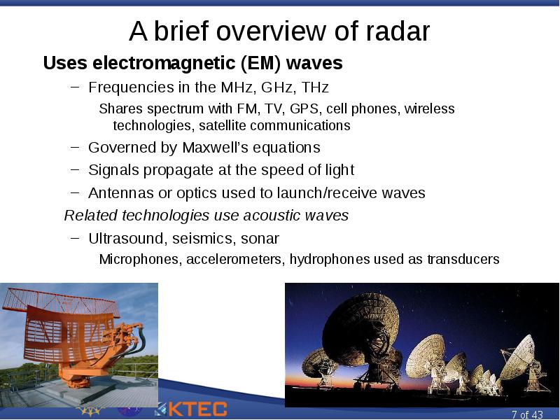
A brief overview of radar Uses electromagnetic (EM) waves Frequencies in the MHz, GHz, THz Shares spectrum with FM, TV, GPS, cell phones, wireless...
Описание слайда:
A brief overview of radar Uses electromagnetic (EM) waves Frequencies in the MHz, GHz, THz Shares spectrum with FM, TV, GPS, cell phones, wireless technologies, satellite communications Governed by Maxwell’s equations Signals propagate at the speed of light Antennas or optics used to launch/receive waves Related technologies use acoustic waves Ultrasound, seismics, sonar Microphones, accelerometers, hydrophones used as transducers

Слайд 8


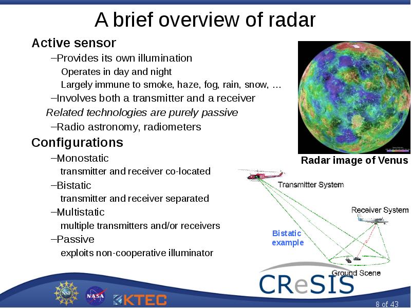
A brief overview of radar Active sensor Provides its own illumination Operates in day and night Largely immune to smoke, haze, fog, rain, snow, …...
Описание слайда:
A brief overview of radar Active sensor Provides its own illumination Operates in day and night Largely immune to smoke, haze, fog, rain, snow, … Involves both a transmitter and a receiver Related technologies are purely passive Radio astronomy, radiometers Configurations Monostatic transmitter and receiver co-located Bistatic transmitter and receiver separated Multistatic multiple transmitters and/or receivers Passive exploits non-cooperative illuminator

Слайд 9


A brief overview of radar Various classes of operation Pulsed vs. continuous wave (CW) Coherent vs. incoherent Measurement capabilities Detection,...
Описание слайда:
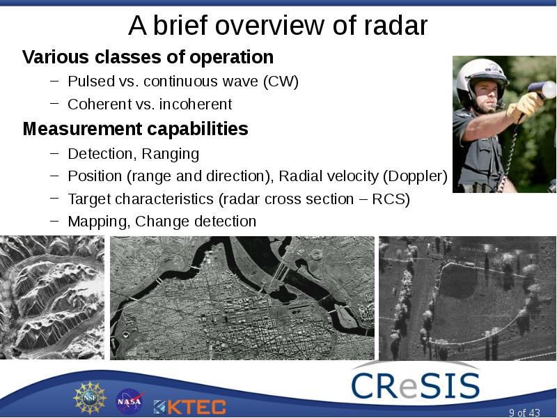
A brief overview of radar Various classes of operation Pulsed vs. continuous wave (CW) Coherent vs. incoherent Measurement capabilities Detection, Ranging Position (range and direction), Radial velocity (Doppler) Target characteristics (radar cross section – RCS) Mapping, Change detection

Слайд 10


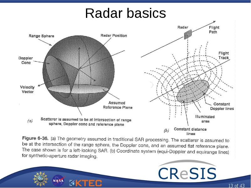
Radar basics
Описание слайда:
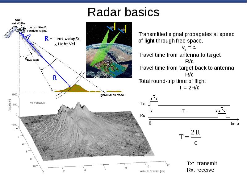
Radar basics

Слайд 11


Radar basics Range resolution The ability to resolve discrete targets based on their range is range resolution, R.
Описание слайда:
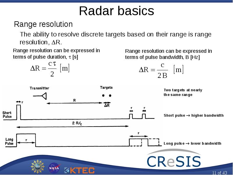
Radar basics Range resolution The ability to resolve discrete targets based on their range is range resolution, R.

Слайд 12


Radar basics Doppler frequency shift and velocity Time rate of change of target range produces Doppler shift.
Описание слайда:
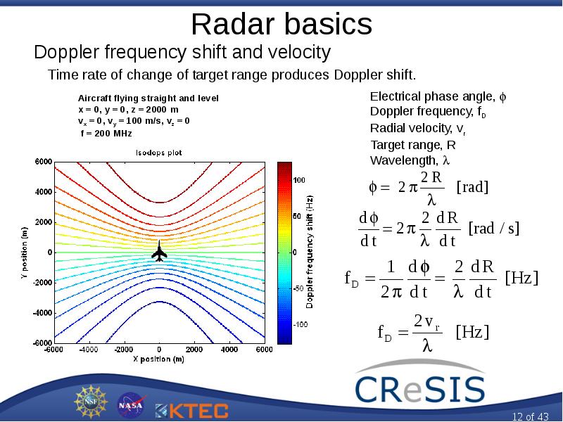
Radar basics Doppler frequency shift and velocity Time rate of change of target range produces Doppler shift.

Слайд 13


Radar basics
Описание слайда:
Radar basics

Слайд 14


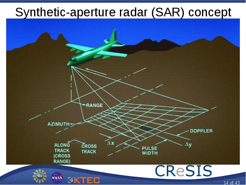
Synthetic-aperture radar (SAR) concept
Описание слайда:
Synthetic-aperture radar (SAR) concept

Слайд 15


Radar and Satellite Remote Sensing, слайд №15
Описание слайда:

Слайд 16


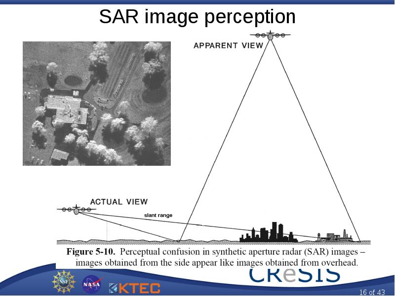
SAR image perception
Описание слайда:
SAR image perception

Слайд 17


Radar and Satellite Remote Sensing, слайд №17
Описание слайда:

Слайд 18


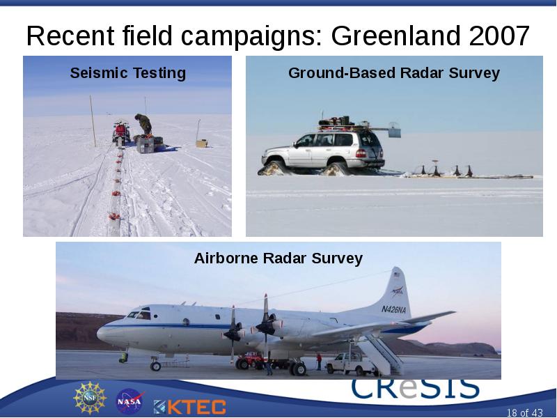
Recent field campaigns: Greenland 2007
Описание слайда:
Recent field campaigns: Greenland 2007

Слайд 19


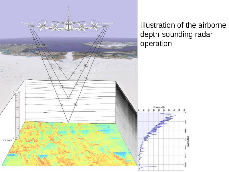
Illustration of the airborne depth-sounding radar operation
Описание слайда:
Illustration of the airborne depth-sounding radar operation

Слайд 20


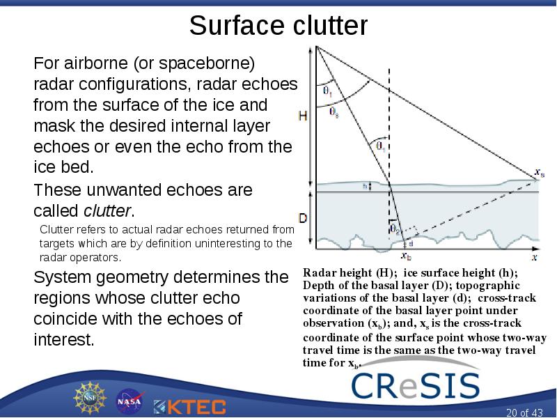
Surface clutter For airborne (or spaceborne) radar configurations, radar echoes from the surface of the ice and mask the desired internal layer...
Описание слайда:
Surface clutter For airborne (or spaceborne) radar configurations, radar echoes from the surface of the ice and mask the desired internal layer echoes or even the echo from the ice bed. These unwanted echoes are called clutter. Clutter refers to actual radar echoes returned from targets which are by definition uninteresting to the radar operators. System geometry determines the regions whose clutter echo coincide with the echoes of interest.

Слайд 21


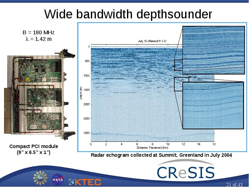
Wide bandwidth depthsounder
Описание слайда:
Wide bandwidth depthsounder

Слайд 22


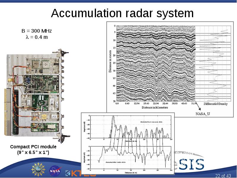
Accumulation radar system
Описание слайда:
Accumulation radar system

Слайд 23


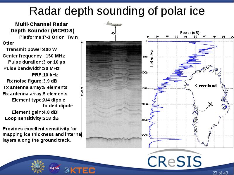
Radar depth sounding of polar ice Multi-Channel Radar Depth Sounder (MCRDS) Platforms: P-3 Orion Twin Otter Transmit power: 400 W Center frequency:...
Описание слайда:
Radar depth sounding of polar ice Multi-Channel Radar Depth Sounder (MCRDS) Platforms: P-3 Orion Twin Otter Transmit power: 400 W Center frequency: 150 MHz Pulse duration: 3 or 10 s Pulse bandwidth: 20 MHz PRF: 10 kHz Rx noise figure: 3.9 dB Tx antenna array: 5 elements Rx antenna array: 5 elements Element type: /4 dipole folded dipole Element gain: 4.8 dBi Loop sensitivity: 218 dB Provides excellent sensitivity for mapping ice thickness and internal layers along the ground track.

Слайд 24


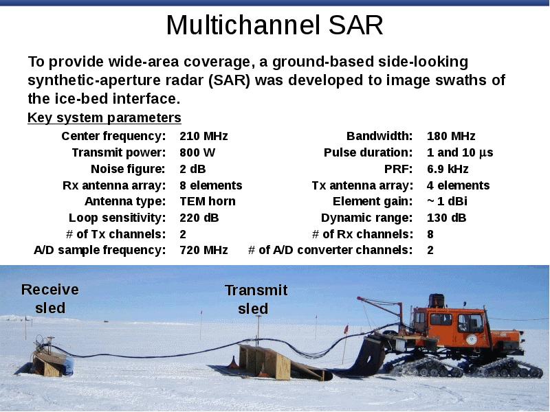
Multichannel SAR To provide wide-area coverage, a ground-based side-looking synthetic-aperture radar (SAR) was developed to image swaths of the...
Описание слайда:
Multichannel SAR To provide wide-area coverage, a ground-based side-looking synthetic-aperture radar (SAR) was developed to image swaths of the ice-bed interface. Key system parameters Center frequency: 210 MHz Bandwidth: 180 MHz Transmit power: 800 W Pulse duration: 1 and 10 s Noise figure: 2 dB PRF: 6.9 kHz Rx antenna array: 8 elements Tx antenna array: 4 elements Antenna type: TEM horn Element gain: ~ 1 dBi Loop sensitivity: 220 dB Dynamic range: 130 dB # of Tx channels: 2 # of Rx channels: 8 A/D sample frequency: 720 MHz # of A/D converter channels: 2

Слайд 25


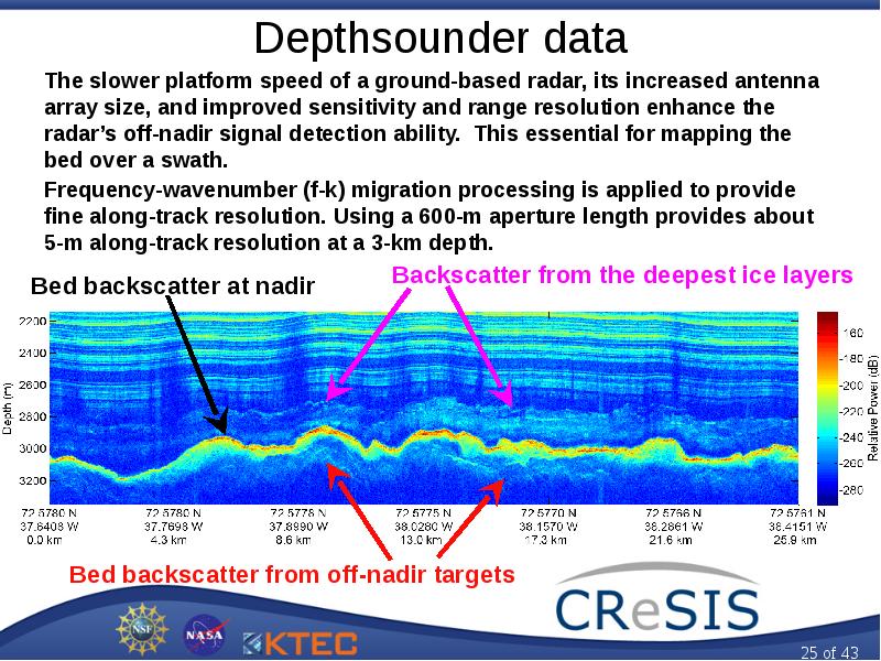
Depthsounder data The slower platform speed of a ground-based radar, its increased antenna array size, and improved sensitivity and range resolution...
Описание слайда:
Depthsounder data The slower platform speed of a ground-based radar, its increased antenna array size, and improved sensitivity and range resolution enhance the radar’s off-nadir signal detection ability. This essential for mapping the bed over a swath. Frequency-wavenumber (f-k) migration processing is applied to provide fine along-track resolution. Using a 600-m aperture length provides about 5-m along-track resolution at a 3-km depth.

Слайд 26


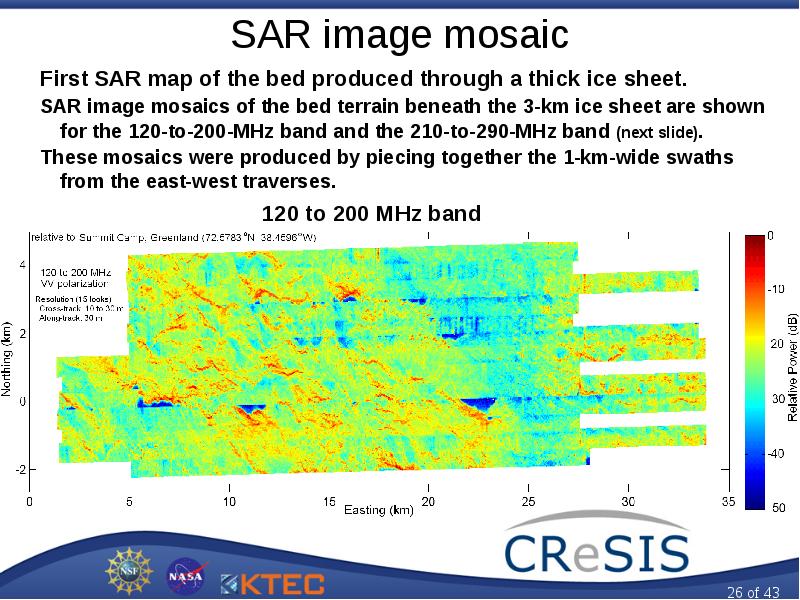
SAR image mosaic First SAR map of the bed produced through a thick ice sheet. SAR image mosaics of the bed terrain beneath the 3-km ice sheet are...
Описание слайда:
SAR image mosaic First SAR map of the bed produced through a thick ice sheet. SAR image mosaics of the bed terrain beneath the 3-km ice sheet are shown for the 120-to-200-MHz band and the 210-to-290-MHz band (next slide). These mosaics were produced by piecing together the 1-km-wide swaths from the east-west traverses.

Слайд 27


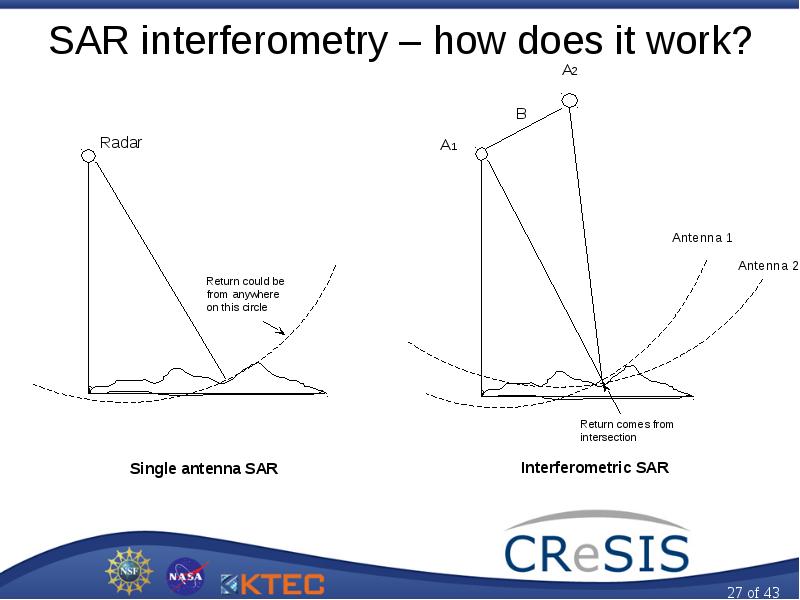
SAR interferometry – how does it work?
Описание слайда:
SAR interferometry – how does it work?

Слайд 28


Radar and Satellite Remote Sensing, слайд №28
Описание слайда:

Слайд 29


Radar and Satellite Remote Sensing, слайд №29
Описание слайда:

Слайд 30


Satellite sensing
Описание слайда:
Satellite sensing

Слайд 31


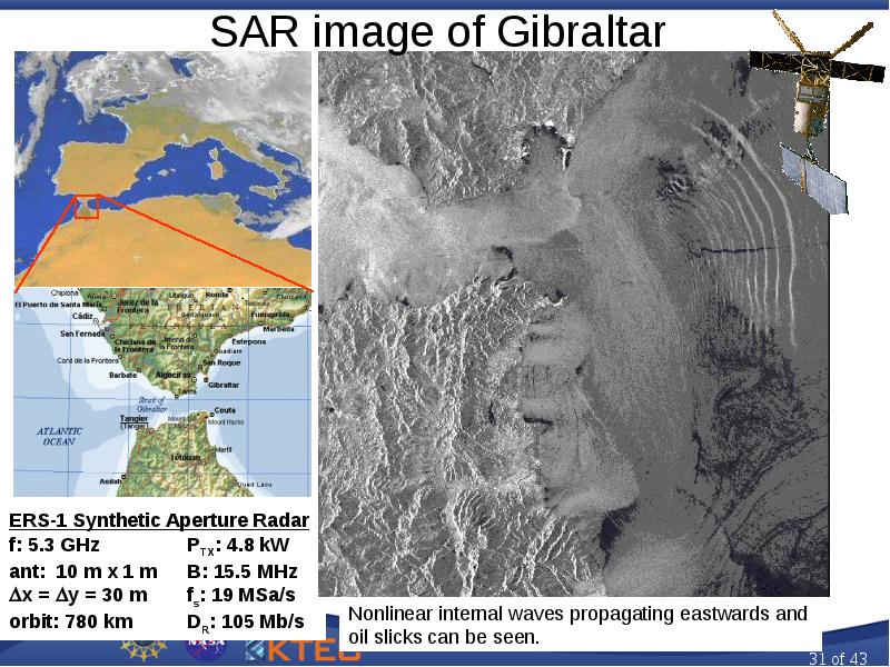
SAR image of Gibraltar
Описание слайда:
SAR image of Gibraltar

Слайд 32


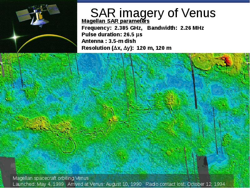
SAR imagery of Venus
Описание слайда:
SAR imagery of Venus

Слайд 33


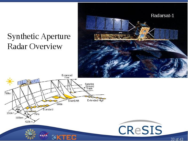
Radar and Satellite Remote Sensing, слайд №33
Описание слайда:

Слайд 34


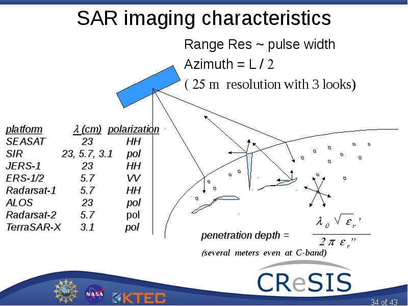
SAR imaging characteristics Range Res ~ pulse width Azimuth = L /  m resolution with 3 looks)
Описание слайда:
SAR imaging characteristics Range Res ~ pulse width Azimuth = L /  m resolution with 3 looks)

Слайд 35


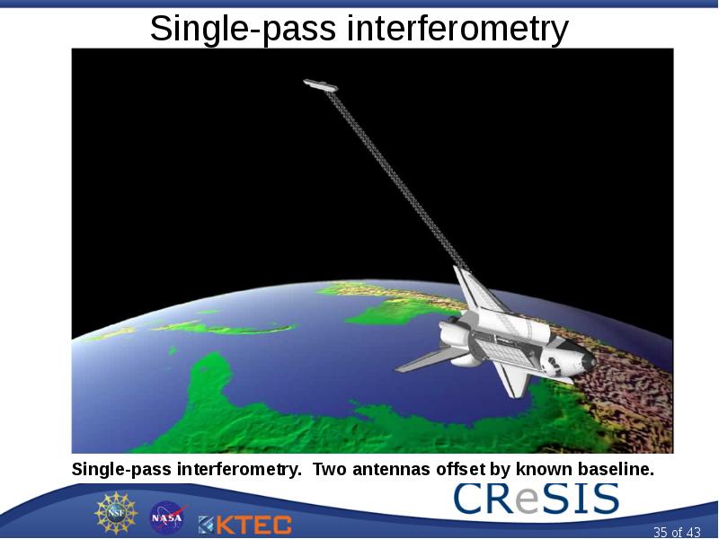
Single-pass interferometry
Описание слайда:
Single-pass interferometry

Слайд 36


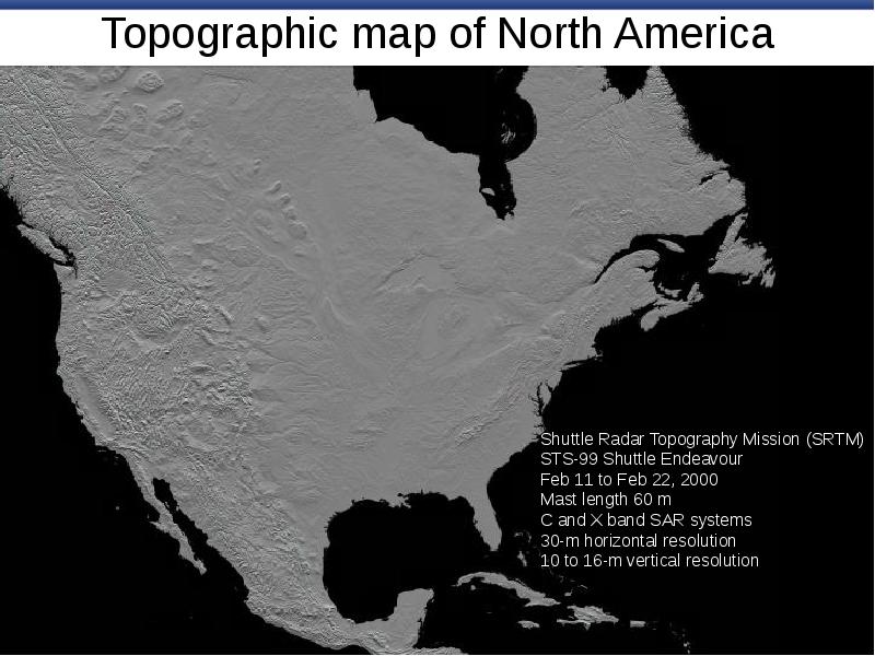
Topographic map of North America
Описание слайда:
Topographic map of North America

Слайд 37


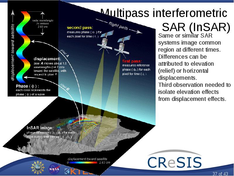
Multipass interferometric SAR (InSAR)
Описание слайда:
Multipass interferometric SAR (InSAR)

Слайд 38


Radar and Satellite Remote Sensing, слайд №38
Описание слайда:

Слайд 39


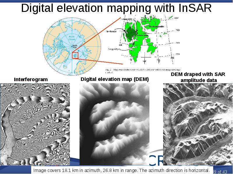
Digital elevation mapping with InSAR
Описание слайда:
Digital elevation mapping with InSAR

Слайд 40


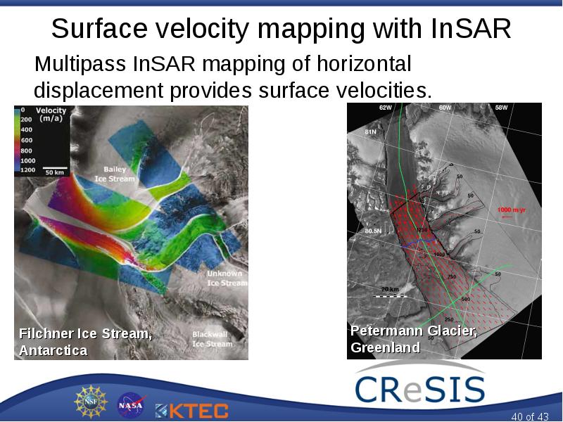
Surface velocity mapping with InSAR Multipass InSAR mapping of horizontal displacement provides surface velocities.
Описание слайда:
Surface velocity mapping with InSAR Multipass InSAR mapping of horizontal displacement provides surface velocities.

Слайд 41


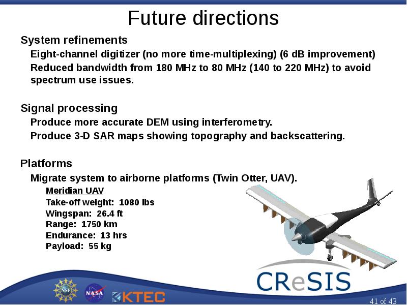
Future directions System refinements Eight-channel digitizer (no more time-multiplexing) (6 dB improvement) Reduced bandwidth from 180 MHz to 80 MHz...
Описание слайда:
Future directions System refinements Eight-channel digitizer (no more time-multiplexing) (6 dB improvement) Reduced bandwidth from 180 MHz to 80 MHz (140 to 220 MHz) to avoid spectrum use issues. Signal processing Produce more accurate DEM using interferometry. Produce 3-D SAR maps showing topography and backscattering. Platforms Migrate system to airborne platforms (Twin Otter, UAV). Meridian UAV Take-off weight: 1080 lbs Wingspan: 26.4 ft Range: 1750 km Endurance: 13 hrs Payload: 55 kg

Слайд 42


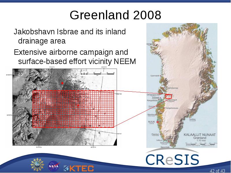
Greenland 2008 Jakobshavn Isbrae and its inland drainage area Extensive airborne campaign and surface-based effort vicinity NEEM coring site
Описание слайда:
Greenland 2008 Jakobshavn Isbrae and its inland drainage area Extensive airborne campaign and surface-based effort vicinity NEEM coring site

Слайд 43


Radar and Satellite Remote Sensing, слайд №43
Описание слайда:


Похожие презентации
Mypresentation.ru
Загрузить презентацию